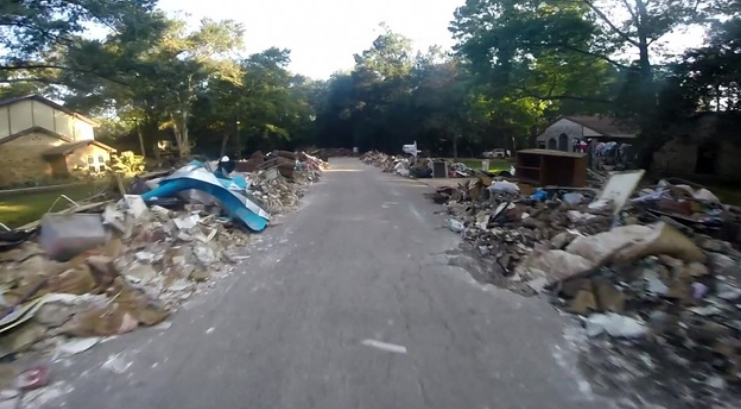
 The piles of debris left outside homes across Southeast Texas only begin to tell the story of devastation left by Hurricane Harvey. From Matagorda to Greater Houston to Orange, Harvey left a path of destruction in communities throughout EHF’s 57-county service area.
More than 50 inches of rainfall combined with destructive winds on the Texas coast made the recipe for a historic storm. Seventy-five people died. There have more than 703,000 applications for disaster assistance from FEMA. At least 200,000 homes were impacted by floods.
As recovery begins, EHF is working with the Episcopal Diocese of Texas, Episcopal Relief and Development and other philanthropic organizations to determine a long-term plan for regional assistance.
Recovery through EHF Research
EHF is also contributing to Harvey recovery efforts through several EHF research projects. First, we’ve created an interactive data-mapping tool (featured below) to help national foundations, Texas funders and other recovery efforts better understand the scope of damage across Texas. The tool is designed to give these organizations the best information available to help make good decisions about how to invest in recovery projects that best address the complex needs of our region. In addition, we’re adding other demographic data overlays to the damage map so viewers can see not just where damage occurred, but who was most impacted. For example, the current map includes a map that shows poverty rates of the affected areas.
This map uses preliminary data from FEMA to show the extent of property damage throughout the affected region. Right now, this dats is still limited and shouldn’t be seen as a final and complete assessment of all damage. Instead, it’s the largest data set currently available from FEMA to gauge damage. EHF will continue to update the map as FEMA releases new damage numbers and locations.
You can use the interactive map to zoom into specific geographic areas to get a closer look of the damage estimates. You can even search by county, city or zip code. Learn more by watching the video below that explains in more detail about how to use the map.
Rapid Response Research
In addition to the map, EHF is also interested in supporting recovery from Harvey through rapid response research. We’re concerned that while there is going to be a large amount of government money and philanthropic funding available for Harvey recovery, the voices of the most vulnerable may not be represented during the decisions on how to invest those funds. Therefore, EHF is the process of working with survey research firms to develop rapid response surveys, which will allow us to quantify and present the needs and interests of vulnerable populations. We hope the findings from this “rapid response” research could inform discussions and decisions being made regarding the long-term priorities of rebuilding efforts.
If you are interested in working alongside EHF on these research projects, please contact us via email at HarveyRecovery@Episcopalhealth.org.